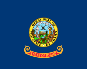
Idaho
History: It is likely that humans were present as long as 14,500 years ago in the Idaho area. The earliest European visitors were French fur trappers, which is why Idaho has so many French place and town names (like Coeur d’Alene). The first non-indigenous settlement was established on the shore of Lake Pend Oreille in 1809. Idaho Territory was considered to be part of the Oregon Country, claimed by both the United States and Britain, until the U.S. finally gained control in 1846. Idaho became the 43rd state on July 3, 1890.
Economy: Idaho is in a middle position in terms of industrial development, making such things as electronics, small boats, and printers. It is one of the top states in tourist income, since it has many places for snow-related recreation. Idaho has some of the richest agricultural land in the U.S. It produces potatoes, wheat, lentils, barley, oats, sugar beets, peas, beans, and alfalfa seed. Forests cover almost two-fifths of the state’s total area, producing lumber and other wood products. Overall, it is a state with a good balance of industry, tourism, and agriculture to provide employment for its residents.
Climate: Because of the many mountains, Idaho has a very diverse climate. The mountainous regions are much colder with more rainfall. However, the high mountains in eastern Idaho block much of the cold winter air that Montana and Wyoming get coming down from Canada, giving Idaho warmer temperatures than them. July temperatures range from about 80 to 90° F (27 – 32° C). The Snake River Plain generally gets less than 10 inches of precipitation yearly, making it the driest part of the state. On the flip side, large parts of the Northern Rockies usually get more than 50 inches of precipitation, most of it in the form of snow.
Geography: Idaho is a northwestern U.S. state known for extensive areas of protected wilderness and recreational areas, as well as scenic mountainous landscapes. Idaho contains dozens of individual mountain ranges and many lakes/rivers. The capital, Boise, is set at the base of the Rocky Mountains, bisected by the Boise River. The Continental Divide comes in from northwestern Canada, then runs south along the Bitterroot Range of the Rocky Mountains. The Snake River Plain is a wide, flat, and fertile region covering all of the southern part of the state.
Fun Facts:
- Idaho’s name comes from a Native American word that means “Land of many waters.”
- Idaho grows nearly one-third of America’s potatoes.
- There are only a few places in the world with “star garnets”; one is India and the other is Idaho.
- There is a canyon in Idaho called “Hell’s Canyon”, which is 7,900 ft deep, deeper than the Grand Canyon.
- Idaho’s capital is the only one using a renewable source of energy called geothermal water; hot water is pumped up from 3,000 ft underground to provide heat.
- Lewiston is a Pacific Ocean port, even though it is 500 miles inland, via the Snake and Columbia Rivers.
Points of Interest:
- Snake River Greenbelt
- Silver City and Burke ghost towns
- Boise Train Depot
- Minidoka National Historic Site
- Treaty Rock Park (Post Falls)
- Craters of the Moon National Monument
Six additional sites to visit for more information:
kids.nationalgeographic.com/idaho


